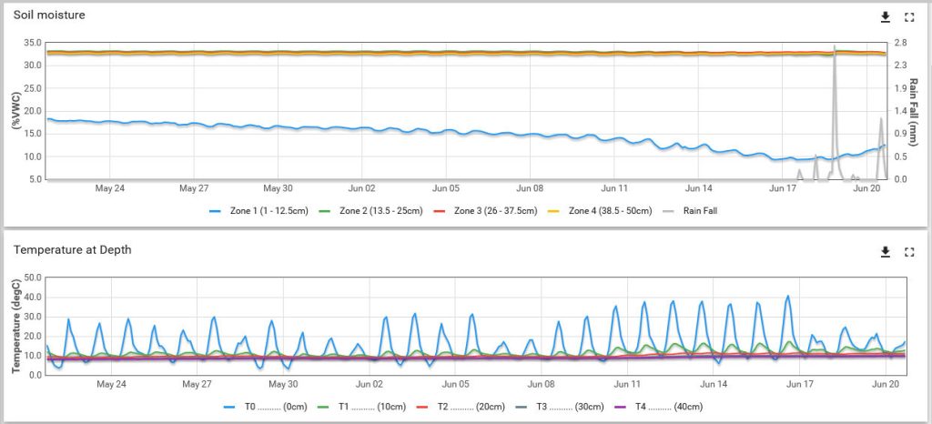
There are a few days each summer when the data from our units point to a high fire risk on Ilkley Moor. This past month has been quite dry and warm and the data shows the top layer drying out – the blue line in the top graph. Being a peat moor, the lower zones remain quite wet, but the top zone is worryingly dry.
At the same time, the surface temperature continually creeps upward (blue line, second graph), finally breaking 40C on the 16th. Some other units in the area have similar data, and together point toward a high fire risk on the moor.
Thankfully, the rains came the next day (grey line on the first graph), slightly raising the top zone moisture while making a big difference in reducing the surface temperature.


